



Pacific Hurricane Season Shatters Records as El Niño Fuels Intense Storm Activity
The Pacific region has set a new record for powerful, long-lasting hurricanes. Experts link the surge in storm intensity to El Niño and warming waters.

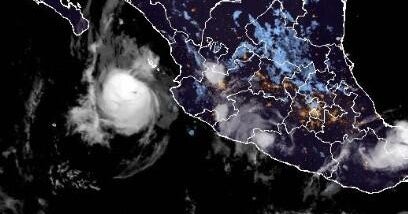
POLICY WIRE — Washington, D.C. — A relentless series of powerful hurricanes in the Pacific has officially broken records for storm longevity and intensity east of the international date line. Scientists attribute this unprecedented activity to a massive El Niño event that has effectively turbocharged the region’s weather patterns.
Colorado State University researcher Phil Klotzbach noted that the activity has been intense since September 20, when Odalys first developed. He observed that nearly every storm forming this year is maintaining strength and duration far beyond typical expectations.
Meteorologists track this activity using accumulated cyclone energy, or ACE, a metric that accounts for both wind speed and the lifespan of a storm. On Sunday, the Pacific region—which impacts Hawaii, Mexico, and the U.S. West Coast—surpassed the previous record established in 2018. With Hurricane Simon currently active and another potential storm forming, the record is expected to climb further.
Klotzbach added that the Pacific is on the verge of setting a new record for the total number of days with an active hurricane. University of Arizona atmospheric scientist Kim Wood remarked that the current environment seems to facilitate the development of almost every potential storm system.
Researchers point to El Niño as the primary driver, as it alters high-altitude vertical winds. By reducing wind shear, the phenomenon allows storms to travel with a tailwind rather than facing resistance. Conversely, this same pattern has suppressed Atlantic hurricane activity, which currently sits at less than 18% of its normal ACE for this time of year.
Water temperatures are also playing a critical role, with equatorial Pacific waters measuring several degrees Fahrenheit warmer than average. Kristen Corbosiero, a professor at the University at Albany, explained that these elevated temperatures, fueled by both El Niño and climate change, provide the necessary energy for sustained storm growth.
Typically, Pacific storms struggle to maintain intensity because they churn up cooler water from the depths. However, this year has been an exception. Hurricane Rachel, for instance, remained powerful even after passing through the wake of the Category 5 Hurricane Polo, as the deep, warm water prevented the usual cooling effect.
A persistent atmospheric spin over Central America, known as a gyre, has further contributed to the season by acting as a nursery for storm development. This system helped spawn both the Atlantic’s Isaias and the Pacific’s Simon simultaneously.
The five most recent Pacific hurricanes—Nolo, Odalys, Polo, Rachel, and Simon—all reached major status with winds exceeding 111 mph. Notably, Polo maintained Category 5 strength for two-and-a-half days, setting a new record for duration at that intensity.
While the National Oceanic and Atmospheric Administration typically divides the Pacific into two distinct regions, both are experiencing hyperactive conditions simultaneously for the first time. Experts suggest this synchronization is a direct result of the widespread low shear, high moisture, and warm water temperatures across the entire basin.
Looking ahead, the National Hurricane Center is monitoring a disturbance off the Mexican coast with a 90% chance of developing into Tropical Storm Trudy. Corbosiero noted that as long as favorable conditions persist, the region is likely to see continued storm formation.
Reporting by Policy-Wire (PW)