


India’s UN Map Vote Backfires: Kashmir Dispute Exposes Cartographic Contradiction
When a Map Became a Sovereignty Crisis
India’s latest cartographic episode has produced an almost spectacular diplomatic paradox as New Delhi enthusiastically backed a United Nations initiative intended to improve the geographical...

India’s latest cartographic episode has produced an almost spectacular diplomatic paradox as New Delhi enthusiastically backed a United Nations initiative intended to improve the geographical accuracy of world maps, only to become spooked, rattled and visibly uncomfortable when attention shifted towards how disputed territories might actually be represented.
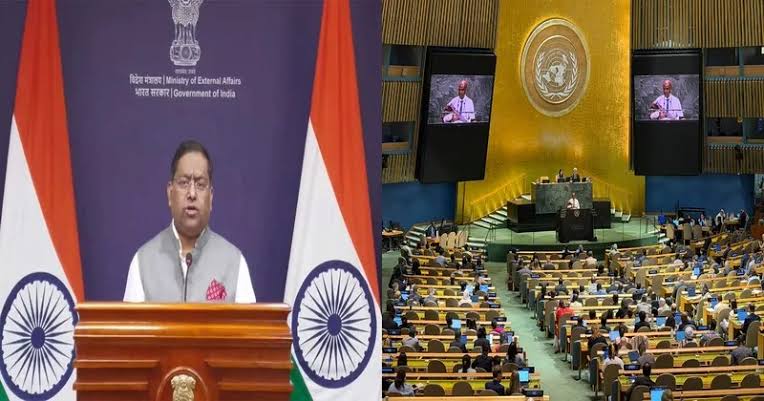
The United Nations General Assembly adopted a resolution promoting equal-area map projections, designed to portray the relative size of countries and continents more accurately. India voted in favour. Yet once Jammu & Kashmir and Ladakh entered the discussion, cartography rapidly acquired a geopolitical dimension.
New Delhi then clarified that its support for the resolution should not be construed as acceptance of any particular map or territorial depiction. What had begun as an innocuous discussion about cartographic methodology suddenly became a question of sovereignty.
India was comfortable with the principle. It became considerably less comfortable with the picture.
The reaction reveals a deeper geopolitical reality that maps are never neutral when they intersect with contested borders. Cartography can institutionalise narratives, reinforce territorial claims and shape public perceptions of legitimate boundaries. Yet its authority has limits. It can communicate a claim, but it cannot independently create sovereignty.
That distinction is particularly consequential in Jammu & Kashmir and Ladakh. The broader disputed region remains divided among different administrations, while India, Pakistan and China maintain competing territorial positions. India’s official cartography may depict territory according to its sovereign claims, but colouring a disputed area does not erase the realities of administration, control or competing claims elsewhere. Likewise, representing Aksai Chin as Indian territory does not place it under Indian control.
A line drawn on a map is not equivalent to a line enforced on the ground. A border printed in an official document cannot substitute for effective administration, physical control, international diplomacy or negotiated settlement. In disputed territories, sovereignty remains contested precisely because these dimensions do not align.
New Delhi’s apparent alarm therefore carries significance beyond the immediate controversy. If India’s position is that its official maps represent an unquestionable sovereign reality, why was it necessary to distance its UN vote from territorial depictions that might emerge from the broader cartographic exercise? The clarification suggests that India did not recognise a distinction between endorsing a technical mapping principle and endorsing every political implication that could follow from its application.
That raises an uncomfortable question of diplomatic due diligence. Territorial representation is hardly an unforeseen sensitivity in South Asia. Any international initiative touching global cartography was bound to intersect with disputed boundaries. A more carefully calibrated diplomatic position could have anticipated the problem before the vote. Instead, the concern surfaced after attention turned towards the map.
The result resembles cartographic buyer’s remorse as India supported the principle, only to become baffled by the political realities accompanying it.
States use maps in textbooks, official documents, government websites and diplomatic communications to normalise particular territorial narratives. Repetition can make contested boundaries appear settled to domestic audiences. Yet international acceptance cannot be manufactured through repetition alone.
Digital maps, satellite imagery, geographic databases and visual representations can influence perceptions alongside traditional diplomacy. Whoever controls the representation of territory gains an instrument for shaping discourse. But representation remains distinct from possession.
That distinction undermines the assumption that cartographic certainty can generate geopolitical certainty. A government may colour disputed territory in national colours, attach preferred labels and draw boundaries with absolute confidence. None of these actions automatically resolves the underlying dispute.
Reality is considerably more stubborn than cartographic editing.
For India, the episode consequently presents a striking contradiction. New Delhi supports an international initiative premised on improving geographical representation, yet becomes rattled when the discussion highlights the political complexity surrounding territories it claims. The issue is not that maps are inherently hostile to sovereignty. Rather, greater cartographic scrutiny can expose the difference between a state’s preferred territorial narrative and the fragmented realities on the ground.
Perhaps, then, the problem was never the projection. Perhaps it was what the projection revealed.
Territorial disputes cannot be settled by cartographic confidence. Maps can preserve claims, institutionalise narratives and communicate aspirations, but they cannot transform contested territory into uncontested sovereignty. The status of disputed lands depends on a complicated interaction of administration, effective control, international law, diplomatic recognition and political settlement.
India can publish an elaborate map of Kashmir. It can colour Ladakh according to its preferred boundaries and label Aksai Chin as it wishes. But a cartographer’s pen cannot annex territory, just as a government proclamation cannot manufacture international consensus.
The irony is therefore sharper than the map itself. India voted for a principle intended to make the world’s geographical picture more accurate, only to become visibly spooked when accuracy intersected with geopolitics.
Maps may draw borders.
They cannot draw away disputes.
Author