


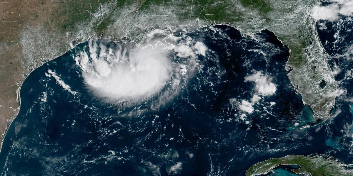
Tropical Storm Edouard Intensifies, Threatens Texas and Louisiana with Flooding
POLICY WIRE — Miami, USA — Tropical Storm Edouard is moving towards the Gulf Coast and is expected to intensify, posing a threat of heavy rainfall and flooding to parts of Texas and Louisiana. The...

POLICY WIRE — Miami, USA — Tropical Storm Edouard is moving towards the Gulf Coast and is expected to intensify, posing a threat of heavy rainfall and flooding to parts of Texas and Louisiana.
The storm was upgraded from a tropical depression on Monday night. Forecasters at the National Hurricane Center predict it will make landfall in Texas later on Tuesday.
As of early Tuesday, the storm was located approximately 65 miles south-southeast of Cameron, Louisiana, and 90 miles southeast of Port Arthur, Texas. It had maximum sustained winds of 40 mph and was moving west-northwest at 8 mph.
Texas Governor Greg Abbott highlighted that flooding is the primary concern. The National Hurricane Center anticipates 3-6 inches of rain in the greater Houston area, with some regions along the state’s upper coast receiving up to 9 inches. Rainfall rates could exceed 4 inches per hour, leading to flash flooding in low-lying and urban areas.
Orlando Alanis from the Texas Division of Emergency Management stated, This is our first significant storm of the season, and Texas is prepared.
Crews have been working to remove dry vegetation that could spark fires from lightning strikes, as noted by Abbott.
Meanwhile, the remnants of Tropical Storm Dolly have brought rain and thunderstorms to parts of Haiti, the Dominican Republic, the Turks & Caicos, and the Bahamas.
📄 POLICY WIRE WHITEPAPER PUBLISHED: PAKISTAN’S NATIONAL SECURITY POLICY PRIORITIES
In the Pacific Ocean, Tropical Storm Lowell, located about 630 miles southeast of Hilo, Hawaii, has maximum sustained winds of 70 mph and is moving west at 10 mph. Forecasters predict it could rapidly intensify into a major hurricane by Wednesday.
Also in the Pacific, Tropical Storm Marie formed early Tuesday far off the southwest coast of Mexico and is not currently threatening land. The storm is about 470 miles southwest of Manzanillo with maximum sustained winds of 45 mph and is moving northwest. It is expected to become a hurricane in the coming days.
Hurricane Karina, which strengthened into a Category 4 storm, remains far from any landmass, centered 1,210 miles west-southwest of the southern tip of Mexico’s Baja California peninsula with maximum sustained winds of 140 mph.
Reporting by Policy-Wire (PW)