



Tropical Threat Brews in Gulf of Mexico With U.S. Impact Possible This Weekend
A new tropical system in the Gulf of Mexico threatens the U.S. Gulf Coast with heavy rain this weekend as hurricane season enters its final weeks.

POLICY WIRE — Washington, United States — With under two months left before the conclusion of the hurricane season, a developing tropical threat in the southern Gulf of Mexico could potentially impact the United States this weekend.
The Atlantic season officially commenced on June 1 and has produced just eight named storms so far this year, as El Niño conditions have instead fueled a more active Pacific season. The current Atlantic hurricane season is scheduled to conclude on November 30.
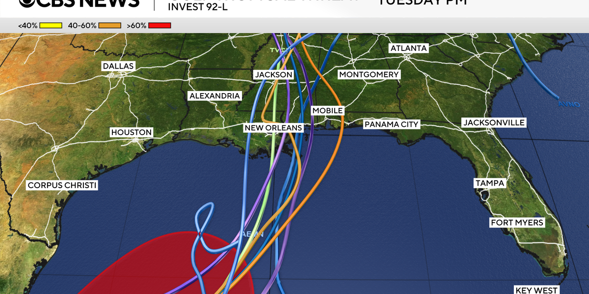
Tropical Depression Nine officially took shape in the Gulf on Tuesday, though considerable uncertainty persists as the system churns over warm waters off the coast of Mexico in the Bay of Campeche.
Computer forecast models are beginning to reach a consensus indicating that a northward trajectory will steer the tropical system toward the Gulf Coast over the course of the weekend.
Regardless of whether the system acquires a name or strengthens into a formal tropical storm, forecasters warn it will deliver moderate to heavy rainfall across the Gulf Coast and throughout the wider Southeast from the weekend into early next week.
Longer-range meteorological models also suggest this abundant moisture could eventually track into the Ohio Valley and the Northeast by the middle of next week.
Key details including the exact timing, ultimate storm intensity, and severity of land impacts associated with the system remain undetermined at this stage.
📄 POLICY WIRE WHITEPAPER PUBLISHED: PAKISTAN’S NATIONAL SECURITY POLICY PRIORITIES
While certain forecasting models indicate potential impacts could begin as early as Friday evening, others point to a later arrival over the weekend.
Uncertainty likewise surrounds the intensity forecast for the system, with some models projecting it will remain a tropical depression while others anticipate it reaching tropical storm status.
Should the system intensify into a tropical storm, it will be assigned the name Isaias, which is pronounced ees-ah-EE-ahs.
While the frequency and formation of tropical storms and hurricanes fluctuate across the season, systems beginning with the letter I have historically accounted for the highest number of retired names within the Atlantic basin.
Prominent examples of retired I-named storms include Ian in 2022, Ida in 2021, Irma in 2017, and Irene in 2011.
Following the retirement of Ike in 2008, Isaias was introduced to replace the I designation on the Atlantic tropical cyclone naming lists, which operate on a six-year rotation.
Reporting by Policy-Wire (PW)